Offline Maps and Navigation: How to Never Get Lost
Never get lost again. Master offline maps and traditional navigation for when technology fails.
Introduction
In today’s world, digital navigation is second nature. We rely on Google Maps or Apple Maps for daily commutes, holidays, or finding the nearest restaurant. But what if you’re hiking in the Highlands, your phone dies, or a disaster knocks out the mobile network?
Offline navigation and traditional map skills are critical for travel, outdoor adventures, and emergency preparedness.
This in-depth guide will show you how to master both digital and paper navigation—so you’re never lost, anywhere, anytime.
Why You Should Care About Offline Navigation
- Technology can fail: Dead batteries, lost phones, broken screens, or just “no signal” moments.
- Emergencies: Blackouts, natural disasters, or civil emergencies can disrupt cell networks and GPS.
- Travel and exploration: Rural UK, European mountains, or remote global travel often lack reliable coverage.
- Peace of mind: Offline skills = independence, confidence, and real safety.
Quick Comparison: Online vs Offline Navigation
| Feature | Online Maps | Offline Maps |
|---|---|---|
| Requires internet | Yes | No (maps downloaded ahead) |
| Uses mobile data | Yes | No |
| Real-time traffic | Yes | Usually no |
| Battery use | High (if using GPS/data) | Lower (no data, just GPS) |
| Reliability in remote areas | Low | High (if prepped in advance) |
| Emergency-ready | No | Yes |
The Best Offline Map Apps for UK & Global Use
Offline map apps let you download maps in advance so you can navigate without signal. Here’s a detailed comparison of top options:
| App | Platform | Free/Paid | Key Features | Best For |
|---|---|---|---|---|
| Google Maps | iOS, Android | Free | Download custom areas, navigation, bookmarks | City driving, travel |
| Maps.me | iOS, Android | Free | Full world offline, hiking trails, POI | Hikers, backpackers |
| Organic Maps | iOS, Android | Free | Privacy, no ads, open-source, hiking & cycling data | Privacy, outdoors |
| OsmAnd | iOS, Android | Free/Paid | Custom layers, voice nav, GPX import/export | Advanced users |
| Gaia GPS | iOS, Android | Free/Paid | Topo & Ordnance Survey maps, route tracking | Outdoor adventure |
| AllTrails | iOS, Android | Free/Paid | 200,000+ trail maps, offline GPS, community reviews | Walkers, runners |
| ViewRanger | iOS, Android | Free/Paid | UK OS maps, AR skyline view, GPX import | UK countryside |
| Komoot | iOS, Android | Free/Paid | Cycling, hiking, curated routes, offline nav | Biking, route planning |
Pro Tip: Try two apps for redundancy—if one fails or gets buggy, you have a backup.
How to Download & Use Offline Maps (Step-by-Step)
Step 1: Choose & Install Your App
Select from the table above. Popular for UK hikers: Maps.me or Organic Maps (both are 100% free).
Step 2: Download Your Map Areas
- Google Maps:
- Search destination area
- Tap your profile picture → “Offline Maps” → “Select Your Own Map”
- Zoom/drag, then tap Download
- Maps.me/Organic Maps:
- Open app, zoom to area, download prompt will appear or access map download menu.
- OsmAnd:
- Tap menu → “Download maps” → Choose region/country.
Tip: Download extra buffer around your planned route in case you go off-track.
Step 3: Save Key Places & Markers
- Home, hotel, car park, trailhead, water sources, friends’ houses, emergency services
- Drop pins or add bookmarks so you can navigate back easily.
Step 4: Test Your Setup
- Switch phone to airplane mode.
- Open offline map app, search for your pins, plot a route.
- Walk/drive a short test to confirm GPS works without network.
Step 5: Update Regularly
- Map data changes, especially city streets or public transport.
- Re-download before any major trip.
Power: How to Keep Your Phone Alive
- Carry a high-capacity power bank (10,000–20,000 mAh is ideal).
- Charge overnight before your trip.
- Switch to airplane mode when not actively navigating—GPS works, but battery drains slower.
- Dim screen brightness.
- Carry a car charger or solar charger for remote travel.
How Offline Maps Work
- Maps are stored as files on your phone.
- GPS still works offline—uses satellites, not mobile signal.
- App pinpoints your location by receiving GPS satellite signals.
- Some apps let you record and export tracks, even without the internet.
Traditional Navigation: Map & Compass Never Fail
If your phone dies, you’re not out of options.
Paper maps and a simple compass are the ultimate backup!
Why Carry a Paper Map?
- Never needs charging.
- Works in all weather, day or night.
- Lets you plan alternative routes on the fly.
- Can be used for group navigation (everyone can see).
Understanding Paper Maps
Types of Maps
| Type | Best For | UK Example |
|---|---|---|
| Road Maps | Car journeys, big scale | AA Road Atlas, OS Travel Maps |
| Topographic Maps | Walking, hiking | Ordnance Survey (OS Explorer, Landranger) |
| City/Street Maps | Urban navigation | A-Z City Atlas, local tourist maps |
UK Hikers:
- OS Explorer (1:25,000): best for walkers—shows field boundaries, footpaths, contour lines
- OS Landranger (1:50,000): good for wider area overview
Reading a Paper Map: Key Skills
- Orient the map: Lay it flat, line up north on map with real north (using a compass).
- Read the legend: Learn symbols for paths, woods, water, buildings.
- Use the grid: UK OS maps use grid references—learn to read and quote “six-figure grid” for accurate location.
- Judge distances: Use the scale (e.g., 1cm = 250m on Explorer maps).
Compass Basics: How to Use One
| Step | Description |
|---|---|
| Hold the compass flat | Keep it level for accurate reading |
| Set the map north | Align map’s north with compass north |
| Take a bearing | Point compass direction-of-travel arrow to destination, rotate housing until orienting lines match map north |
| Follow your bearing | Walk in the direction the compass shows, keeping the needle on north |
Practice at home: Use a map of your neighbourhood and compass to plot a route before you go.
How to Navigate Without a Compass
- The sun rises in the east, sets in the west.
- In the UK, at noon, your shadow points north.
- Moss grows on the north (shady) side of trees—can be a clue, but not 100% reliable.
- Watch for landmarks (church spires, rivers, main roads) for orientation.
- In the city: follow the grid of streets, note river or railway directions.
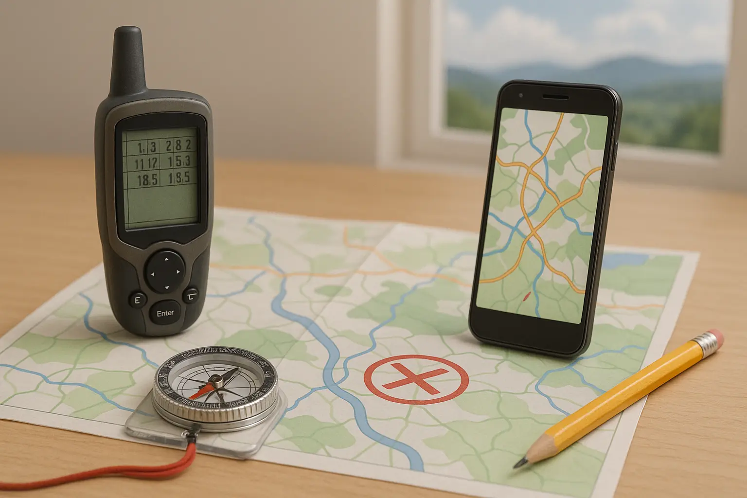
DIY: Build Your Offline Navigation Kit
| Item | Why It’s Useful |
|---|---|
| Printed paper map | Reliable, full view of area |
| Waterproof map case | Keeps map dry in rain, snow |
| Compass | Navigate without electronics |
| Power bank | Emergency phone recharges |
| Highlighter | Mark routes, hazards, key points |
| Notepad & pencil | Write down grid refs, emergency info |
| Emergency whistle | Signal if lost (3 blasts = distress) |
| Emergency contact card | Write key numbers in case of phone loss |
Bonus:
Print out emergency evacuation routes for home, work, and school, and keep them in your bag or glovebox.
UK & Europe: Real-World Navigation Scenarios
Hiking in the UK
- Download offline map for your area (e.g., Peak District) in Maps.me or Organic Maps.
- Carry an OS Explorer paper map for the region.
- Mark your start point, key trail junctions, and “bail out” points (pubs, bus stops, main roads).
- Check forecast—fog can make even small hills confusing.
- Tell someone your planned route and ETA.
City Break in Europe
- Screenshot key areas (hotel, main station, attractions) in case app fails.
- Download entire city map for offline use.
- Save addresses and phone numbers in a paper notebook.
- Mark police, hospital, embassy, and “safe spots.”
Emergency Bug Out
- Print and keep a map of your region in your emergency bag.
- Pre-mark evacuation routes, safe houses, petrol stations, water sources.
- Practice driving or walking routes before you need them in real life.
Common Navigation Mistakes (And How to Avoid Them)
| Mistake | Solution |
|---|---|
| Relying only on your phone | Always have paper map and compass as backup |
| Not downloading enough area | Add buffer zones around your route |
| Forgetting to update maps | Refresh before trips; check app updates |
| No backup power for devices | Carry at least one power bank (charged!) |
| Getting turned around in fog or at night | Pause, orient map, retrace to last known point |
Navigation FAQ
How much space do offline maps use?
City: 100–200MB, entire UK: up to 1GB. Plan storage before long trips.
Will GPS work without internet?
Yes! GPS in your phone works independently of mobile data. Most apps will locate you on downloaded maps.
Can I use a compass app instead of a real compass?
Digital compasses are fine for quick checks, but may be inaccurate if your phone battery is low or hardware is faulty.
A simple magnetic compass is more reliable in emergencies.
How can I improve my map skills?
Take an orienteering course, watch YouTube tutorials, or practice local walks with paper maps.
What’s the best offline app for hiking in the UK?
For footpaths and topo info: OS Maps (subscription for full features), Maps.me, or Organic Maps.
Top Tips: Never Get Lost Again
- Download and test your offline maps before setting off.
- Carry at least one paper map and compass—know how to use them!
- Practice navigation on local walks, even in the city.
- Always tell someone your route and ETA.
- Don’t panic if lost: stop, breathe, orient yourself, and make a plan.
- Recharge devices and pack a backup battery for every trip.
Resources & Learning
- Ordnance Survey Map Reading Skills
- Mountain Rescue Navigation Advice
- Learn Orienteering (UK resource)
Conclusion
Being able to find your way—with or without technology—is one of the most important survival skills.
With the right offline apps, a backup power source, and solid map/compass know-how, you’ll always know where you are, where you’re going, and how to get back.
Never leave home without a map. Your adventure—and your safety—depend on it!
Have questions or want printable checklists for your next trip? Drop a comment below!